The successful conclusion of the Treaty of Paris in early 1783 prompted a number of European publishers to issue maps expressly of the “United States of America.” Some American publishers did likewise, of course, but they served only regional markets with relatively small press runs, and their maps are today very rare indeed.
All of the maps in this section kept the framing of the older maps of the colonies (such as Faden’s British Colonies in North America), from the Atlantic to the Mississippi River and from Newfoundland to Florida. Their frame might have been tightened to omit Florida (still Spanish) and the Maritimes (still British), but at this moment there was no sense of some greater westward destiny. The map sold by the successful book publisher Thomas Cadell, made in Thomas Kitchin’s productive workshop, exemplifies the maps that were made and sold to the British public in factual acknowledgment of the new country.
Europe Celebrates Benjamin Franklin as the Architect of the USA
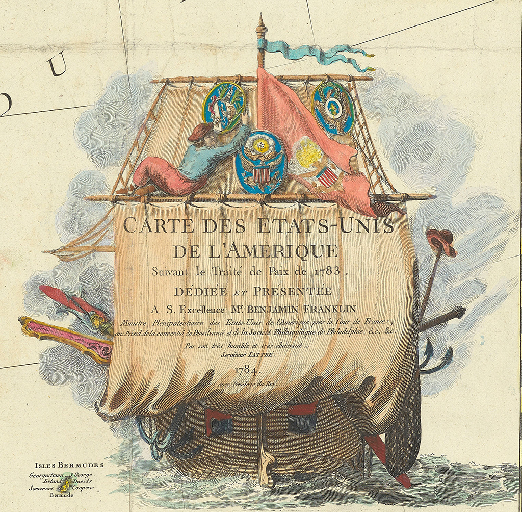
Other European mapmakers, however, in addition to factual acknowledgement, further paid homage to or actively celebrated American independence by praising the colonial intellectual who was well known in London and Paris and who had played a key role in the treaty negotiations: Benjamin Franklin. In Paris, for example, Jean Lattré produced a large map that he dedicated to Franklin, the title and dedication written across the mainsail of the new ship of state; many impressions of this map, as here, have separately printed side panels listing the main events of the Revolution.
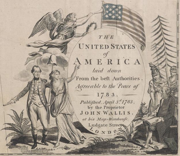
In London, two publishers, neither known for other maps, produced maps of the United States that recognized both Franklin and George Washington for their respective roles in founding the new nation. The ornate title decoration to John Wallis’s United States of America possesses three dramatic elements. Above, an angel heralds the Stars and Stripes while holding a laurel wreath (the crown of the Roman emperors). At left, in front of the clouds of war, General Washington ushers forward Liberty, who holds a pole capped by a pileus (in ancient Rome, slaves were marked by their shaved scalps, so when they were given their freedom they were also given the pileus, a felt cap, to wear until their hair regrew; the cap atop a pole was a common sign of political freedom and liberty in eighteenth-century England, and can also be seen in the title cartouche to John Green’s map of New England from 1755). At right, in front of a pineapple (emblem of generosity and hospitality), Franklin’s writing is guided by both Minerva (Roman goddess of wisdom and intellect, symbolized by the owl, the bird that can see in the dark and so knows things otherwise kept hidden and secret) and blind Justice, wielding both her sword and scales.
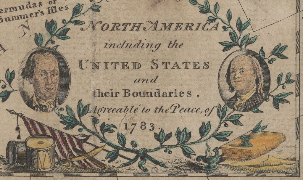
Wallis’s notion of dual authority was followed in John Fielding’s small map, with its busts of Washington and Franklin and their respective military and literary emblems. However, Fielding’s prominent delineation of the boundaries of the United States is quite wrong! Instead of the western boundary stretching to the Mississippi River, Fielding places it in the Appalachians, as it would have been in 1774. The irony is that more people in Britain would likely have seen and been informed by Fielding’s smaller and cheaper map than would have seen the larger and more expensive works by Wallis, Kitchin, and others.